Back رودينغ فالي (محطة مترو أنفاق لندن) Arabic Roding Valley (stanice metra v Londýně) Czech Roding Valley (London Underground) German ایستگاه متروی رودینگ ولی Persian Roding Valleyn metroasema Finnish Roding Valley (métro de Londres) French 羅町佛里站 GAN Roding Valley metróállomás Hungarian Roding Valley (metropolitana di Londra) Italian Roding Valley (metropolitana de Londra) LMO
| Roding Valley | |
|---|---|
 Station entrance, northern side | |
| Location | Buckhurst Hill |
| Local authority | Epping Forest London Borough of Redbridge |
| Managed by | London Underground |
| Number of platforms | 2 |
| Accessible | Yes[1] |
| Fare zone | 4 |
| London Underground annual entry and exit | |
| 2018 | |
| 2019 | |
| 2020 | |
| 2021 | |
| 2022 | |
| Railway companies | |
| Original company | London and North Eastern Railway |
| Post-grouping | London and North Eastern Railway |
| Key dates | |
| 1 May 1903 | Track laid (GER) |
| 3 February 1936 | Opened (LNER) |
| 29 November 1947 | Closed (LNER) |
| 21 November 1948 | Opened (Central line) |
| Other information | |
| External links | |
| Coordinates | 51°37′01″N 0°02′38″E / 51.61694°N 0.04388°E |
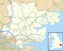
Roding Valley is a London Underground station situated in Buckhurst Hill in the Epping Forest district of Essex, straddling the boundary between that council and Greater London (the London Borough of Redbridge). The station is on the Hainault loop of the Central line between Chigwell and Woodford stations.[7] However, geographically it is midway between Woodford and Buckhurst Hill stations. It is located between Station Way and Cherry Tree Rise (off Buckhurst Way). Since 2 January 2007, the station has been in Travelcard Zone 4.[7]
With around 0.26 million passenger journeys recorded in 2022, Roding Valley is the least used[5] Underground station and hence the most lightly used Underground station. Kensington (Olympia) had 2.10 million underground passenger journeys recorded in 2022, but other services are provided to the station by London Overground and Southern.
- ^ "Step free Tube Guide" (PDF). Transport for London. April 2021. Archived (PDF) from the original on 15 May 2021.
- ^ "Station Usage Data" (CSV). Usage Statistics for London Stations, 2018. Transport for London. 23 September 2020. Archived from the original on 14 January 2023. Retrieved 11 October 2023.
- ^ "Station Usage Data" (XLSX). Usage Statistics for London Stations, 2019. Transport for London. 23 September 2020. Archived from the original on 9 November 2020. Retrieved 9 November 2020.
- ^ "Station Usage Data" (XLSX). Usage Statistics for London Stations, 2020. Transport for London. 16 April 2021. Retrieved 1 January 2022.
- ^ a b "Station Usage Data" (XLSX). Usage Statistics for London Stations, 2021. Transport for London. 12 July 2022. Retrieved 7 September 2022.
- ^ "Station Usage Data" (XLSX). Usage Statistics for London Stations, 2022. Transport for London. 4 October 2023. Retrieved 10 October 2023.
- ^ a b Standard Tube Map (PDF) (Map). Not to scale. Transport for London. April 2024. Archived (PDF) from the original on 28 May 2024. Retrieved 3 June 2024.
